
What can historians learn from digital tools such as Geographic Information Systems and text-mining? What tools do we need that we don’t have yet?
I started my project to plot all protests, riots and political meetings in late 18th and early 19th century northern England years ago, when hardly any historical sources were digitised. I read the Northern Star and other newspapers in their original copies, or, more often, in badly fading microfilm copies on rickety readers in local libraries. Pencil and paper were my central ways of recording each meeting, by hand, and then plotting them, like an old-school geographer, with coloured pencils on a photocopy of a historic map. I compared historic maps side by side to see how urbanisation took hold and street plans expanded and changed.
Now there are many digital sources and tools available to us, that make this process easier:
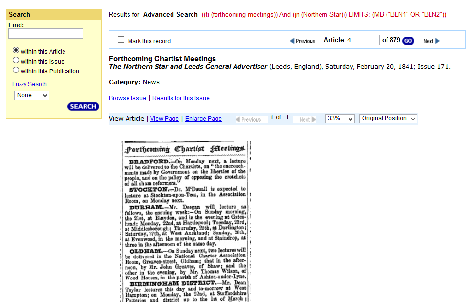
- British Library 19th century newspaper collections online, which includes the Northern Star, so I can search for meetings and other keywords (though with varying rates of accuracy, as the OCR’d text is still notoriously bad)
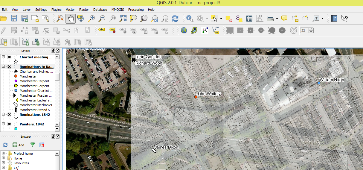
- QGIS, ArcGis, and other Geographic Information Systems software to enable me to geo-reference historic maps, layer them and plot my meeting sites and procession routes on them, so I can see spatial patterns of protest and compare them with urban change
- maptiler and other free or opensource software and platforms to enable me to display historic maps online
- indeed, this very website allowing me to share my research with the wider public in an interactive way, beyond the pages of an expensive and hard to get academic monograph
- google’s various tools, love them or be suspicious of them, that allow me to collate, analyse and display my data, especially Fusion Tables and google earth.
What’s fascinating about layering old maps is seeing ‘it used to be all fields round here’ or grids of streets that were later obliterated by railway or motorway development – see for example the carefully laid out terraces of Chorlton and Hulme that were cleared for the Mancunian Way.
Political Meetings Mapper
The Political Meetings Mapper is my project with British Library Labs, a winning entry in their 2015 competition, and part of the Digital Scholarship department of the British Library.
I developed a tool to extract and map over 5000 Chartist meeting notices from the Northern Star.
Watch this video of me explaining the project at the IHR Digital history seminar on 2 February 2016:
Slideshow explaining the project and methods:
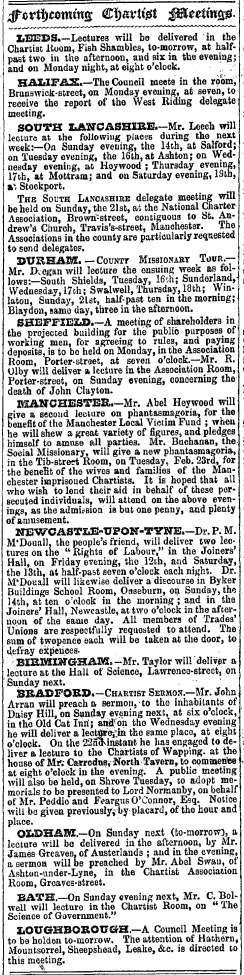
Northern Star, 13 February 1841
2 thoughts on “digital methods & experimentation”