
Humans shape and reshape their physical environment over and over again. It’s now a cliche to call the results of their changes in the landscape as a ‘palimpsest’, but this image from Green’s map of Manchester in 1794 always comes to mind. It shows the outline of the soon to be demolished Chorlton Hall, with the new street plan laid on top.
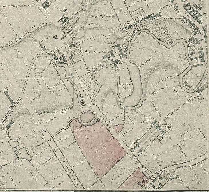
It’s one of the most striking images of this whole period of rapid change. It shows how the medieval past of Manchester – a society of gentry landowners with their obliging (or belligerent) tenants, and fields and smallholdings – rapidly gave way to a new economic landscape at the dawn of the industrial revolution.
The new and modern overlay the old rhythms of the landscape. The newly planned streets pay little attention to existing topographies. Field boundaries have no relevance for the demands of speculative builders soon to fill this area with terraces, factories and warehouses. Whereas Chorlton Hall had been set at a north-east to south-west orientation, the streets are at a slightly different angle. The Hall’s remains, appearing ghostly even in this map, would soon be lost and forgotten as urbanisation rapidly altered the visual and material aspects of this landscape.