
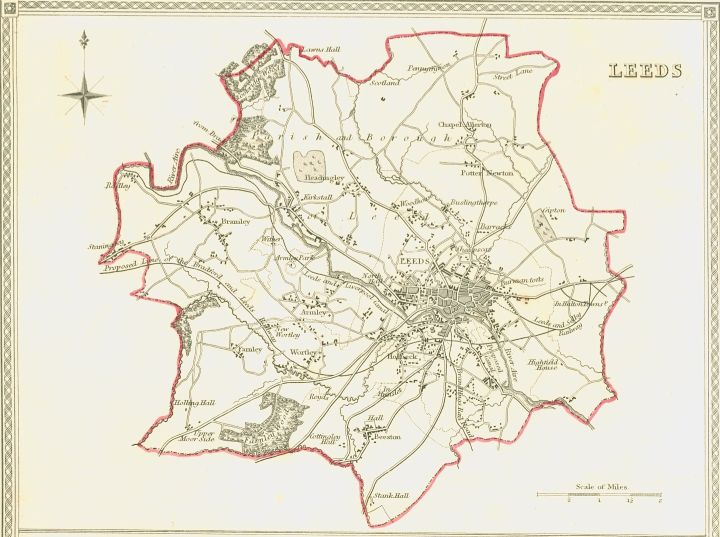
A visitor to Leeds, attentively following their copy of Baines’s Leeds Guide, would have alighted from their coach at an inn on Briggate. They would marvel at the range of shops and markets along the main shopping street, and then perhaps would venture west. Here they would pass alongside some grand commercial and civic buildings, striking in their new and uniform Palladian frontages. On their left was the Coloured Cloth Hall, built …. Opposite, was the Court House, the first major civic building in Leeds, provided for by an improvement act of 1809 and completed in 1815.[1]
[1] Beresford, ‘The Face of Leeds’, p. 107.
The visitor would then reach the leafy and genteel Park estate. Their guidebook noted approvingly:
All the houses are built in a very superior style, and are principally inhabited by affluent merchants or gentlemen who have retired from business. The promenade in Park–Place is, without exception, one of the most pleasing in the town.[1]
[1] Leeds Guide (1806), p. 67.
The Park estate was the first major expansion of the old town westwards. Park Place and its surrounding gridiron of streets of Palladian-style townhouses were built between the early 1760s and 1797. The 140 acres of formerly green fields were owned by Richard Wilson, Recorder of Leeds. St. Paul’s church was the focal point of Park square, offering exclusive pew and internment rights to the residents.[1] At the turn of the century, this was civilised, fashionable and bourgeois Leeds at its height, although this was soon not to last.
Our visitor would thus have passed through a variety of spaces, mostly built within the previous quarter-century. Impression received would be of civic pride and great emphasis on improvement – especially commerce and trade. Shareholders and the merchants of the Corporation sought to use the new buildings to foster a sense of civic pride by connecting it with other significant building endeavours through ritual and festival. The Court House was the starting point for a procession of 160 shareholders to the end of Boar Lane to lay the foundation stone of the new Commercial Buildings in May 1826. This magnificent symbol of the wealth of Leeds’ trade was built at a cost of £30,000.[2]
The commercial district underwent a building boom in the 1820s. The central shopping street Briggate had been obstructed by its medieval remnants Middle Row and the Moot Hall, but these were were demolished in 1825. Briggate was opened up and a new focus for the area was provided by the Corn Exchange on the corner of the Headrow, built at a cost of £12,500.
‘Improvement’ also represented both the extended roles and the stronger sense of authority felt by the governing elites. The siting of the new Court House shifted the locus of authority from the magistrates’ old cramped rooms in Kirkgate to the Palladian uniformity of the Park estate. The demolition of the Moot Hall and Middle Row was symbolic of the Liberal takeover of local government from the Tories who had been associated with the medieval environs of the Moot Hall.[3]
[1] D. Linstrum, West Yorkshire: Architects and Architecture (1978), p. 101; Kevin Grady, Georgian Public Buildings of Leeds and the West Riding (1987), p. 104; R. G. Wilson, Gentleman Merchants: the Merchant Community in Leeds, 1700-1830 (Manchester, 1976), p. 198.
[2] Leeds Mercury, 20 May 1826.
[3] Fraser, History of Modern Leeds, 109.
Leeds popular politics was distinguished by its party-political divides.
As the centre of the woollen trade, Leeds’s largest and most prestigious buildings were cloth halls, and these were used for a variety of public meetings. Read more on the various cloth halls in Leeds: http://www.leodis.net/discovery/.
Notably, the ground floor of the Albion Street music hall became known as ‘Tom Paine’s Hall’ from 1792, where clothiers who had not served the requisite 7 year apprenticeship traded.
Map of political meetings in Leeds, 1789-1848
Click here for the meetings on the cholera map of Leeds in Chadwick’s report:
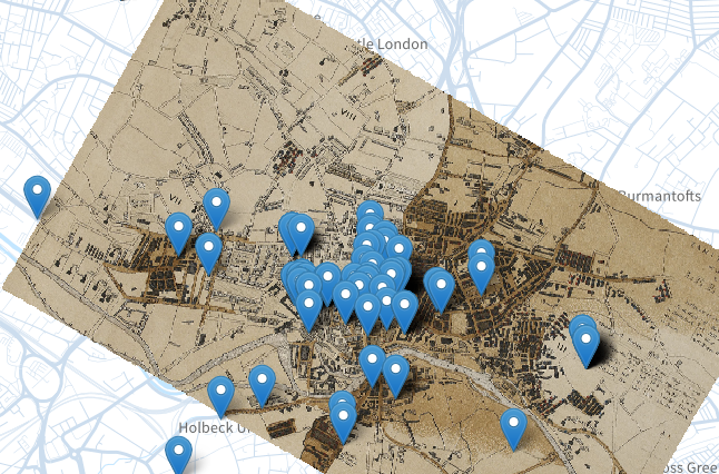
Table of political meetings in Leeds, 1789-1848:
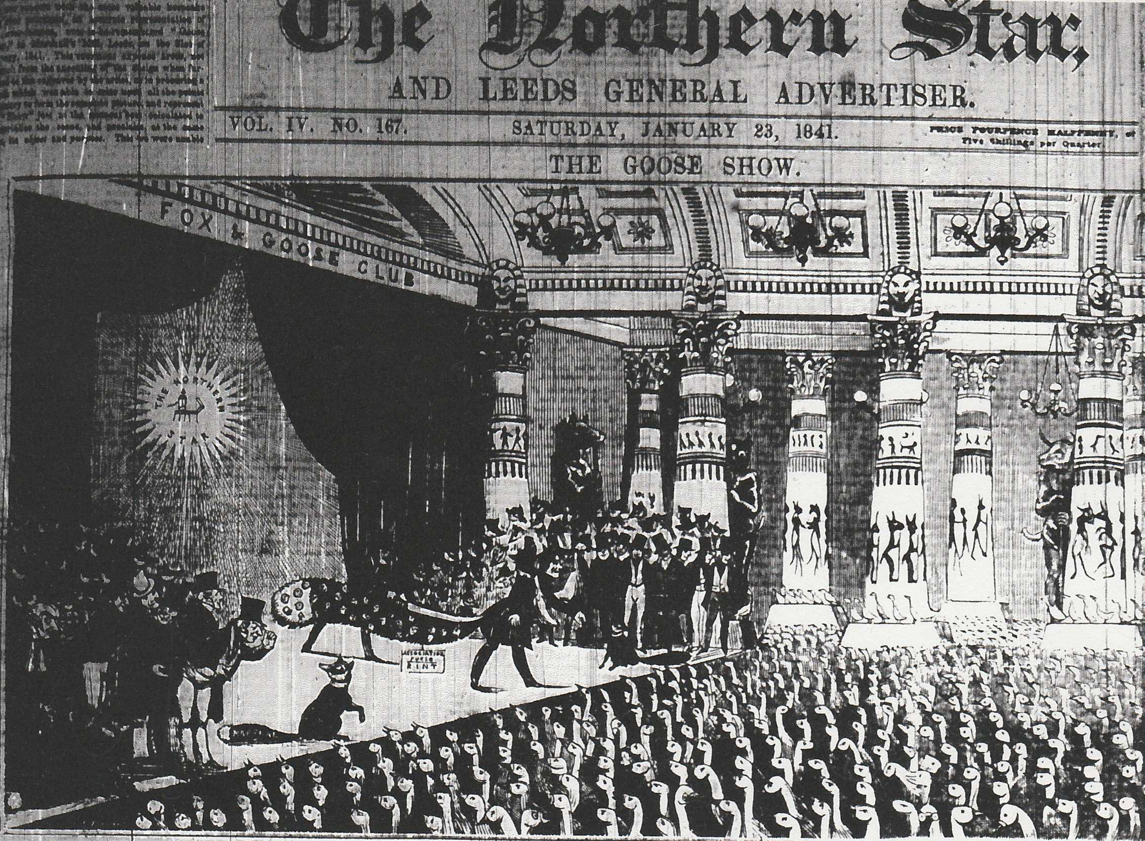
‘The Goose Show, or welcome to Dan meeting’, Northern Star, 23 January 1841:


Protest and the Politics of Space and Place Extended by Katrina Navickas is licensed under a Creative Commons Attribution-NonCommercial-ShareAlike 4.0 International License.
One thought on “Leeds”